Archaeologists believe they are closing in on identifying the wreckage of British explorer James Cook’s ship HMS Endeavour off the USA’s north-eastern coast.
The Rhode Island Marine Archaeology Project (RIMAP) says it has now mapped the sites of nine of a fleet of 13 ships that were scuttled by British forces in shallow water in Newport Harbour in 1778 to form a blockade. One of these wrecks seems likely to be the Endeavour.
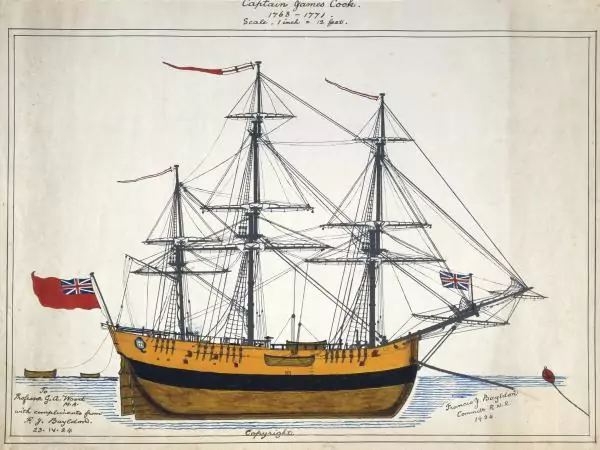
Captain Cook commanded the barque between 1768 and 1771 on the first of his three Pacific Ocean scientific voyages. In this time he claimed islands of Tahiti for Britain, mapped the entire coastline of New Zealand for the first time, and became the first known European to land on Australia’s east coast, at what he named Botany Bay.
The epic voyage is regarded as having shaped world maps to a greater extent than any other in history.
Endeavour was sold off in 1775 and, renamed Lord Sandwich after the then First Lord of the Admiralty, became a British troop transport during the American War of Independence.
RIMAP recently located historic documents in London that identified groups of ships among the 13 and their positions. One group of five ships included the Lord Sandwich.
Four of the five wreck-sites in this group have already been surveyed and, according to recent analysis of remote sensing data, the fifth site may also still exist – which gives RIMAP an 80-100% chance of identifying Endeavour.
The organisation says that a more intense study of each vessel’s structure and related artefacts is needed to bring that about – but it will suspend its investigations until a suitable facility has been built in which to conserve, manage, display and store material recovered from the sites.
This facility is to be sited at Butts Hill Fort, at the centre of the American line during the Battle of Rhode Island, which took place shortly after the British scuttling.