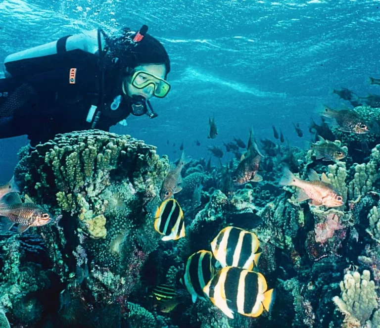
Fewer than 400 people live on this remote Pacific island, described by PIERRE CONSTANT as ‘an enchantment for the eyes’ and, to protect it, no more than 400 visitors are allowed to stay at any one time. It’s a treat under water too, he says
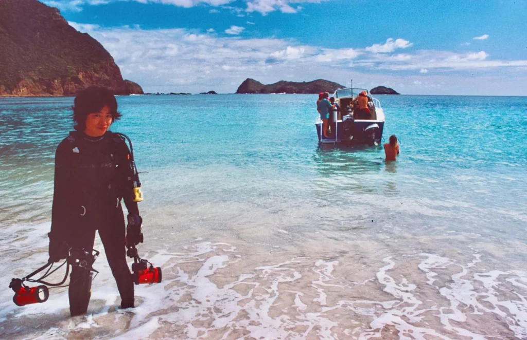
Dressed in his dark green shorts and an almond-coloured shirt, Brian Busteed walks down the beach from the shed. He drags a sea kayak into the water and, petrol container in hand, climbs into it and glides away with a swift movement of his yellow double paddle.
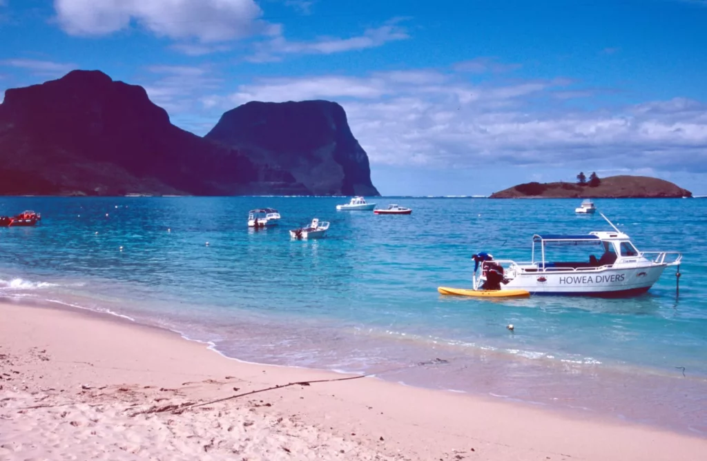
He returns with the Blue Groper, a 6.4m aluminium boat powered by a 200bhp outboard. “Too windy and rough on the other side of the island,” he says. “We won’t dive the Admiralties today. The tidal current is too strong. I’ll take you into the lagoon – we’ll dive Comet’s Hole…”
Originally from Sydney, Brian came to the island one day, fell in love with the place and never left. He created its first dive-centre in 1995.
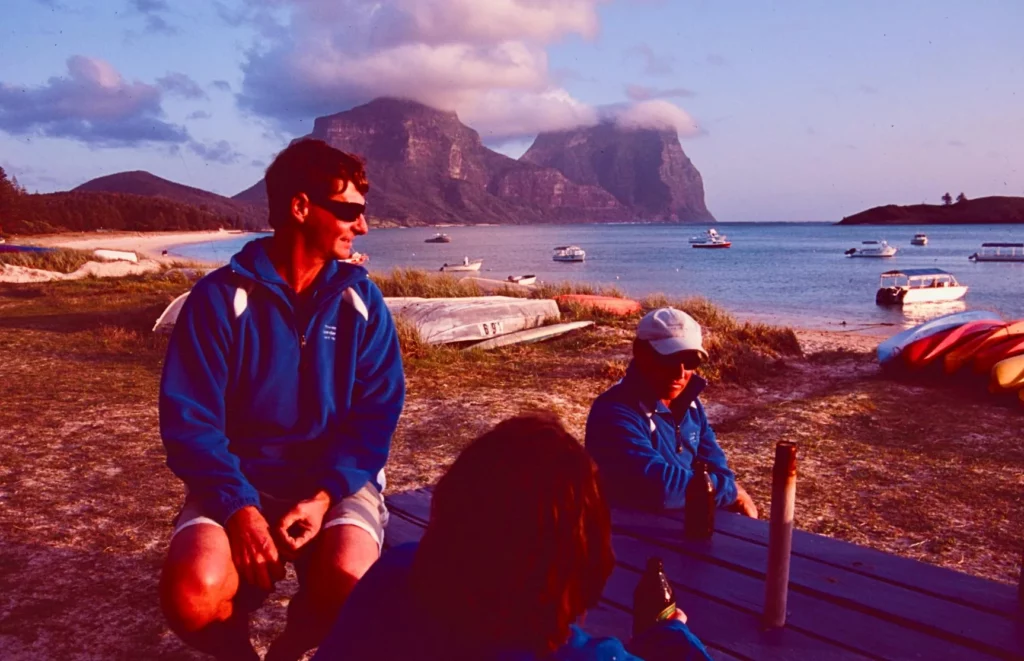
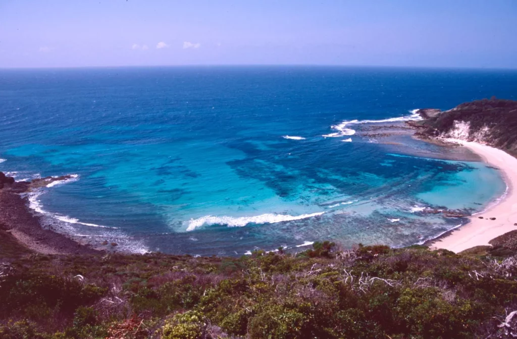
It takes two hours in a small Twin Otter to fly the 700km from Sydney, and the first sight to strike you as you fly over Lord Howe Island is the lagoon. Around noon it turns from turquoise to pastel green, an enchantment for the eyes.
The lagoon is fringed by a white-sand beach leading to some hills, behind which two volcanic outcrops rise abruptly 600m above the ocean, like fortresses. Mt Gower, the island’s highest point, stands at 875m and has an aura of paradise.
Besides casual Australian visitors, few people have heard of this remote corner of the south-west Pacific. Lord Howe Island is 10km long from Mt Eliza in the north-west to King Point in the far south, and 2km at its widest.
About 23km south of the island, Ball’s Pyramid rises majestically to 551m like a gigantic basalt flame. Both Lord Howe and Ball’s Pyramid are volcanic guyots emerging from a seabed 2,000m below.
They are remnants of a chain of islands formed on a 2,000km-long submarine ridge known as the Lord Howe Rise. It stretches from New Zealand to Lord Howe and on to the French-owned Chesterfield Islands, between Queensland and New Caledonia.
Plate tectonics explain the separation from the Australian mainland of this rise 80 million years ago. Lord Howe, 6.9 million years old, was once a 30km-diameter shield volcano. Already mostly submerged, the island should be totally awash within 200,000 years.

The middle part of the island is a dune mixed with skeletons of marine organisms deposited when the sea level was higher than today.
Ancient beaches revealed through fossils the existence of an extinct species of horned turtle, Meiolania platyceps. This land-dweller laid eggs on the beach and dune behind, and had a long bony tail with armed rings.
Similar specimens have been discovered in South Australia, New Caledonia and as far away as Argentina. Extinct for 10-100.000 years, it is the mascot of the Lord Howe Historical Society.
How the island remained in total isolation from humans until the end of the 18th century is a mystery. It was discovered accidentally by Captain David Blackburn on HMS Supply in February 1788 while heading to Norfolk Island, where a penal colony was to be established, and named Lord Howe after the first Lord of the Admiralty, Richard Howe.
A month later, a landing party took possession of the island in the name of the British Crown. In the following decades, Lord Howe was visited by American whaling ships and vessels trading in the South Pacific.
The first settlers arrived on the whaler Caroline in June 1834: three Englishmen from New Zealand, their Maori wives and two boys. They built a house of palms at Old Settlement Beach and made a living by supplying passing whaling ships with wood, water, vegetables and meat.
They survived by eating the chicks of seabirds such as the flesh-footed shearwater or muttonbird.
When whaling declined in the 1870s, settlers found a new source of revenue from outsiders. Charles Moore, once director of Sydney Botanic Garden, realised that the Kentia palm could prove to be an attractive ornamental plant for European homes, and it did. Today it represents an Au $1 million annual revenue for the island.
The small coastal trading vessels of the 1890s made sporadic visits to the island before the arrival of a regular steamship service, on a route from Sydney to Lord Howe, Norfolk Island and the New Hebrides.
Birth of tourism
Australian shipping line Burn Philp’s steamships triggered the birth of tourism in the early 20th century, and Pinetrees and Ocean View became the first lodges to cater for visitors.

In 1931, Francis Chichester landed his floatplane on the lagoon, and flights became reality for Oceanic Airways in 1947, then for Qantas with Catalina flying boats. A 900m airstrip was built in 1974, and the flying-boat service carried 5,000 visitors a year.
The New South Wales and federal governments eventually decided that it was time to provide some environmental protection, and Lord Howe became a UNESCO World Heritage Site in 1982 – the fourth in Australia, after the Great Barrier Reef, Kakadu and Willandra Lakes.
The 1953 Lord Howe Island Act was amended in 1981 to create a permanent park preserve covering untouched areas at the north and south ends of the island, so 70% of it is now totally protected.
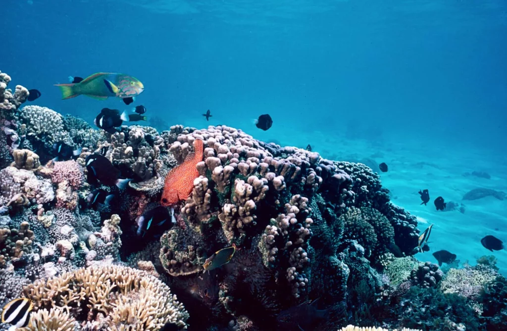
Lord Howe is fascinating for divers because it is the world’s southernmost tropical reef system. The cool Tasman Sea heats up at its latitude, with the warm East Australian Current flowing down from North Queensland before turning east to Lord Howe, so the water stays above 17°C and reaches up to 26°C in summer.
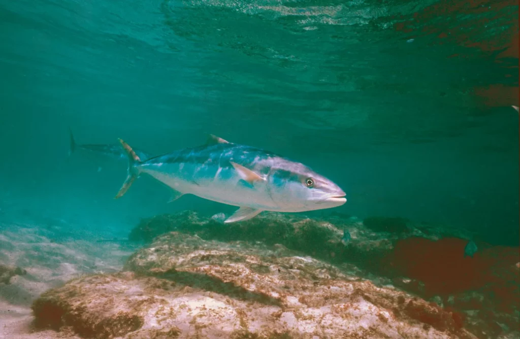
It’s a marvellous avenue for tropical fish larvae and marine organisms, bringing everything from schools of kingfish aka yellowtail (Seriola ialandi), tuna, dolphins and humpback whales.
A National Geographic survey in 1973 recorded 447 species of fish from 107 families. The number has since increased to 500 fish, 200 species of algae and 85 of coral.
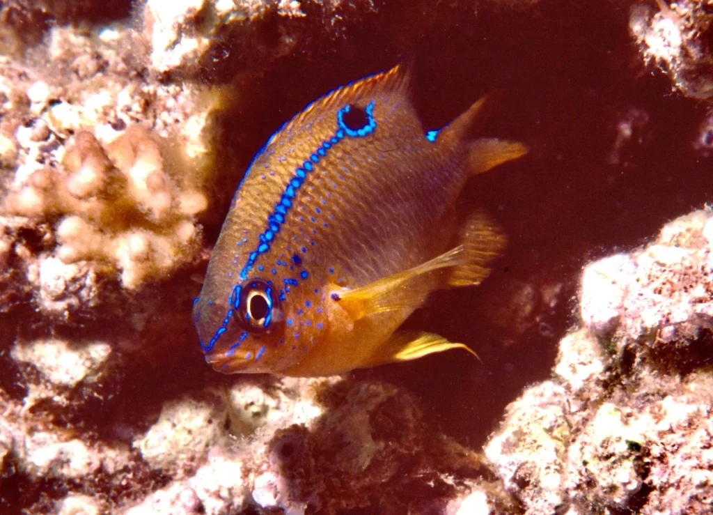
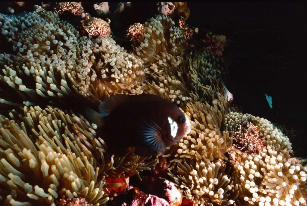
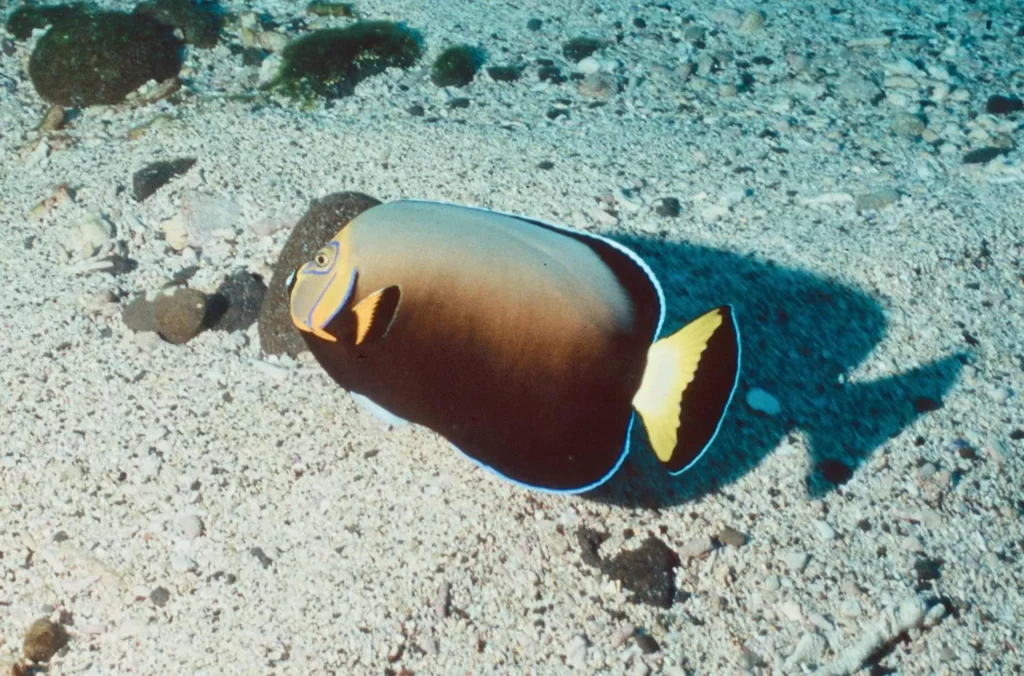
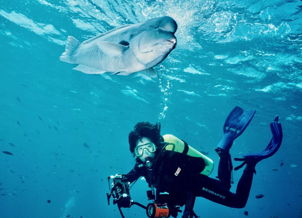
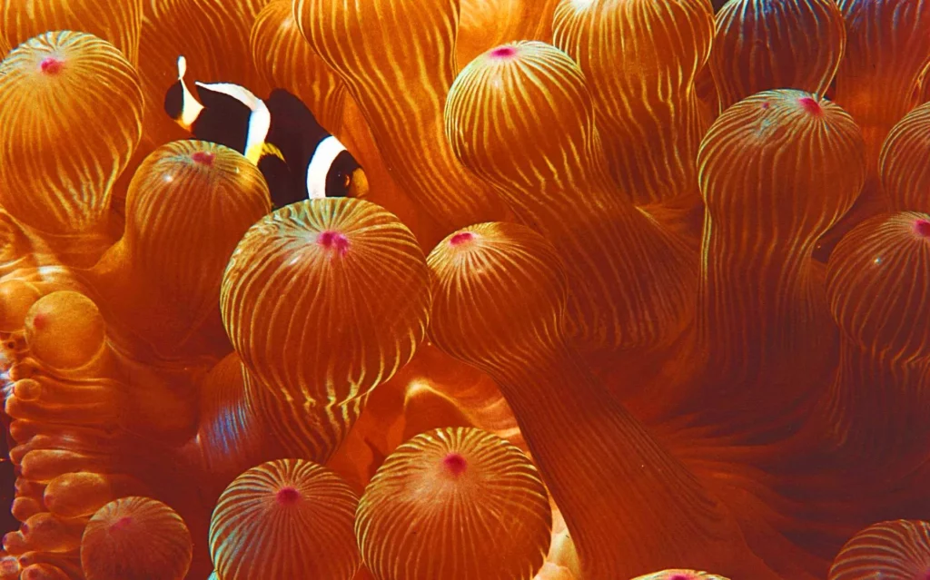
Endemic fish include the black and white McCulloch anemonefish (Amphiprion mccullochi); the double-header wrasse (Coris bulbifrons), blue-grey with a forehead hump; the Lord Howe butterflyfish (Amphichaetodon howensis); and the conspicuous angelfish (Chaetodontoplus conspicillatus). An attractive species is the dusky or black butterflyfish (Chaetodon flavirostris).

Notoriously absent are sharks. A local shark industry and processing plant virtually wiped them out in the 1930s, so consider yourself lucky if you meet the occasional Galapagos shark (Carcharhinus galapagensis), known locally as a Galapagos whaler, reaching a maximum length of less than 1.5m.
Moon wrasse (Thalassoma lunare), sunset, bird and yellow wrasse are quite well represented and mosaic morays (Enchelycore ramosa) are common. Spanish dancers (Hexabranchus sanguineus) and giant sea hares (Aplysia juliana) that grow to 25cm are found on beds of seagrasses.

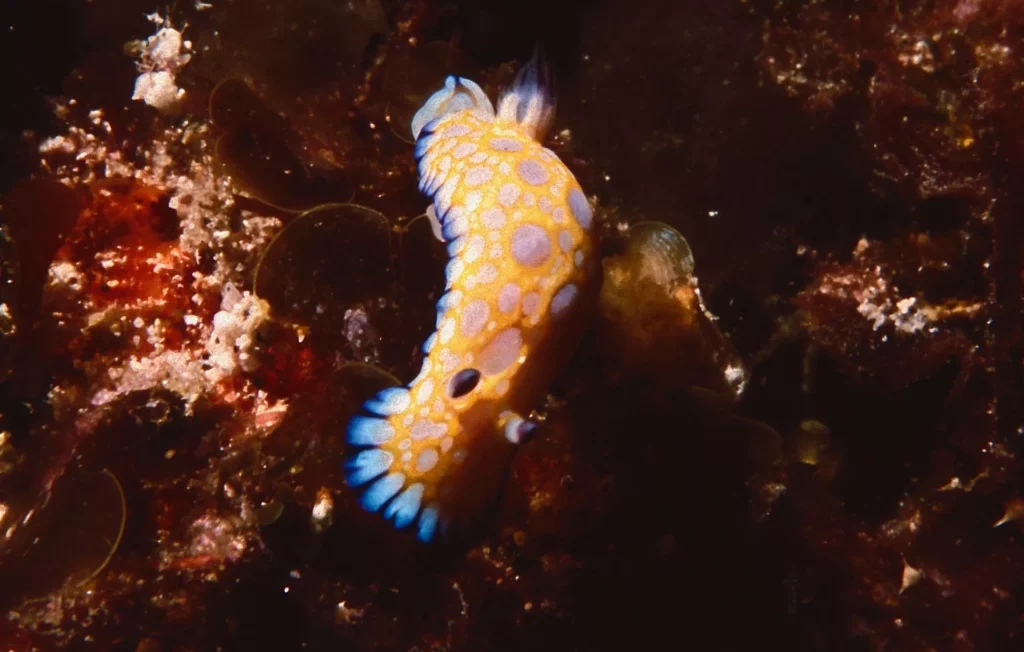
Prickly heart sea urchins litter the sand flats and a great variety of nudibranchs make life exciting for macro photographers: Elizabeth’s chromodoris (Chromodoris elisabethina), Robo’s chromodoris (C roboi) and Kuiter’s chromodoris (C kuiteri).

Umbrella shells in yellow charm, and schools of kingfish, silver trevally (Pseudocaranx dentex) and other jack, spotted sawtail surgeonfish (Prionurus maculatus), spotted sweetlips (Chaetodonoides picus) and blue maomao (Scorpis violaceus) are regular actors. Black-blotched sting rays and green turtles wander above sand and rocks.
Lord Howe’s dive-sites are located on the west and north-east coasts. Known as the “Lagoon Side”, the west side is usually sheltered and includes the North Head Gullies, North Head Cave, the Arch, Comet’s Hole and Erscott Hole sites.
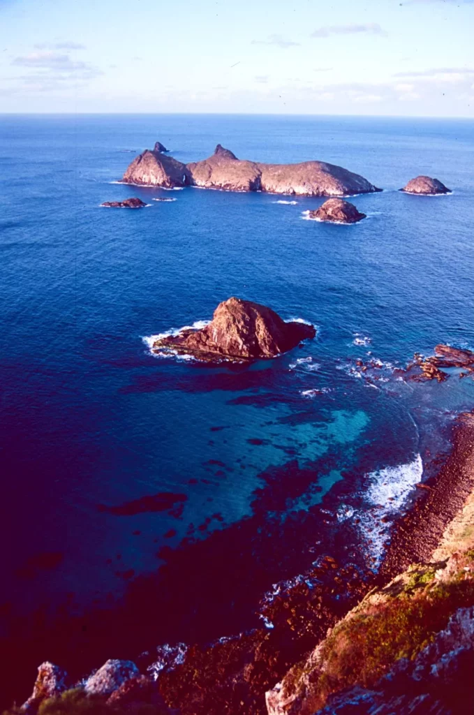
The north-east refers to the Admiralty Islands, Ruppert’s Reef, Roach Island, South Island, Noddy Island, North Rock and 10th of June, where the surge and current can be strong.

When the wind blows from the north-east, it induces swell and troubled waters. Brian checks the weather report and the sea surface situation daily. His choice is always optimal.
Some dive-sites, such as Malabar Wall, Malabar Cave and Old Gulch, at the foot of Malabar Hill and Mt Eliza, are located on the north shore. Most dives are shallow, in the 10-25m range. Deeper sites are found north of the Admiralties at North Rock and 10th of June.

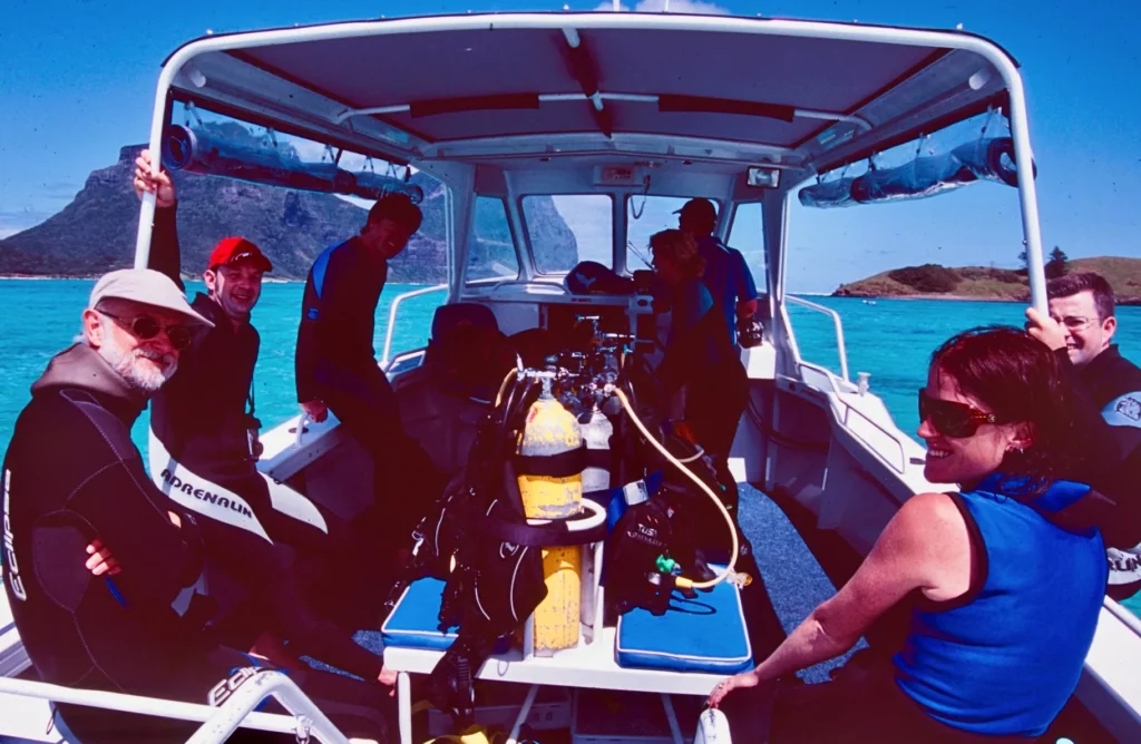
Blue Groper brings divers to the destination in 10-15 minutes, and returns to Lord Howe after every dive for a 40-60min surface interval. An option is to skip the second dive and join the third at 1.30pm.
Lagoon Side
Located south of North Bay at the northern part of the lagoon, North Head Gutter runs east-west through the reef, sometimes forming a tunnel with side-caves and overhangs.
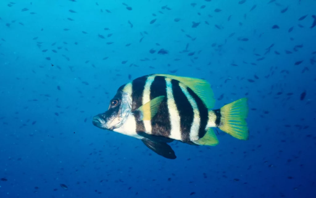
Black-blotched sting rays, moon and double-header wrasse, white-ear damselfish (or scalyfin), moki, painted morwongs and nudibranchs roam the area. A couple of Japanese boarfish hide in the tunnel and swim-throughs. A school of spangled emperors hover above.
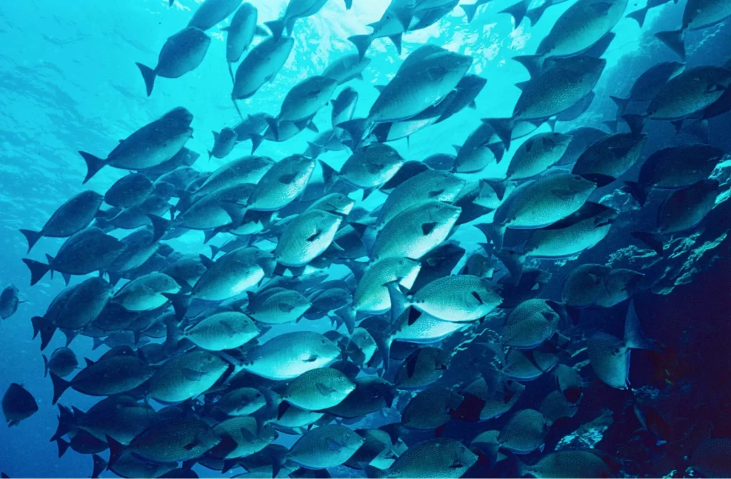
At North Head Cave there are lots of gullies, cracks, tunnels and caves – a maze of canyons in which one can easily lose the way. A large school of spotted sawtail surgeonfish (Prionurus maculatus) inhabits the area, and a school of finny scads is found outside the reef.
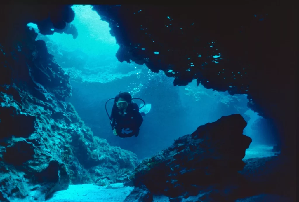
The cave is good for ambience shots. Nudibranchs creep along the wall. The giant sharp-headed hawkfish (Cirrhitichthys oxycephalus), which can reach 25cm long, is the local curiosity and grey speckled moray eels can be seen.
Comet’s Hole is a shallow (8m) pool south of the lagoon and has a sandy bottom. It is Lord Howe’s aquarium, though visibility can be affected by wind action and swell.
Fish assembled here include wrasse, butterflyfish, damselfish, painted morwongs, mosaic morays, flutemouths, schools of silver drummers, trevallies, kingfish and catfish.
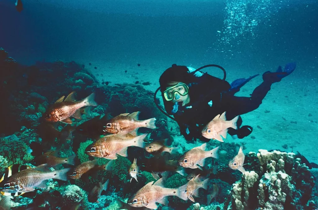
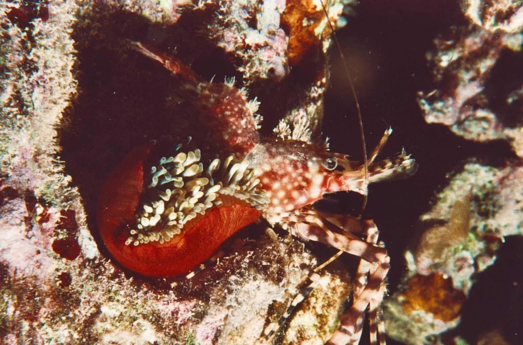
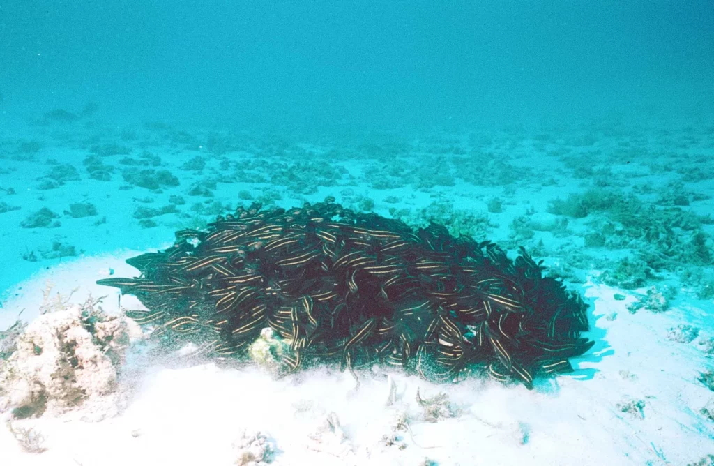
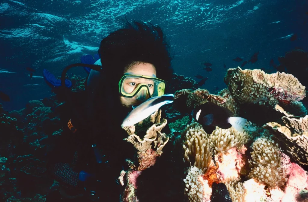
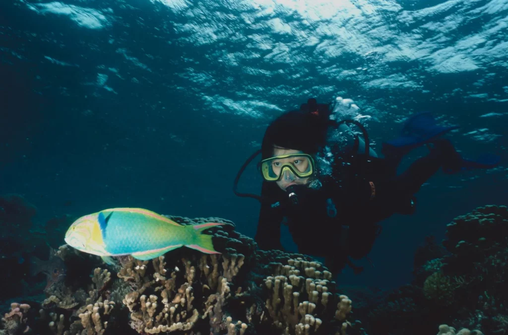
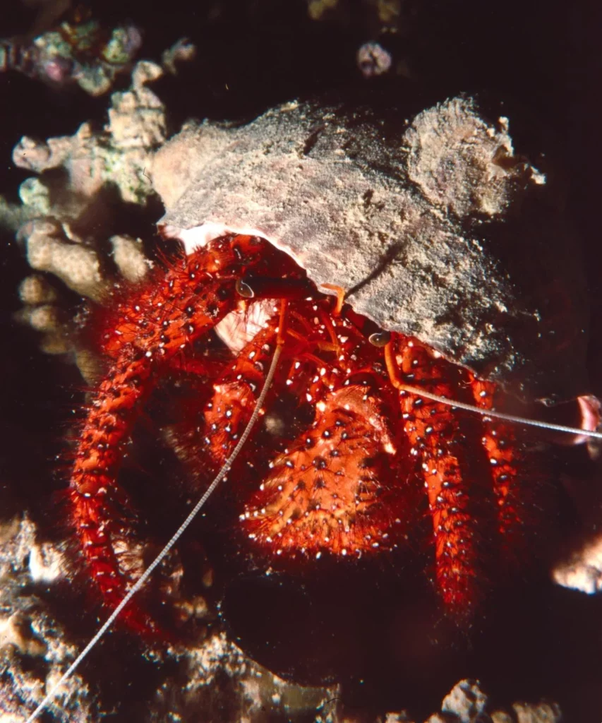
It’s a good spot to observe the endemic McCulloch anemonefish and giant seahares on the grass beds, and great for night dives and the chance to catch the hairy Saron shrimp (Saron marmoratus), tun shells and crabs.
On the west side of the lagoon towards the blue, the Arch is a natural formation in the coral reef. Spotted sweetlips inhabit the place with Japanese boarfish (Evistias acurostris) in pairs, spangled emperors and a school of almaco jack. A couple of gutters south of the arch add to exploration of the site, because there painted lobsters abound.
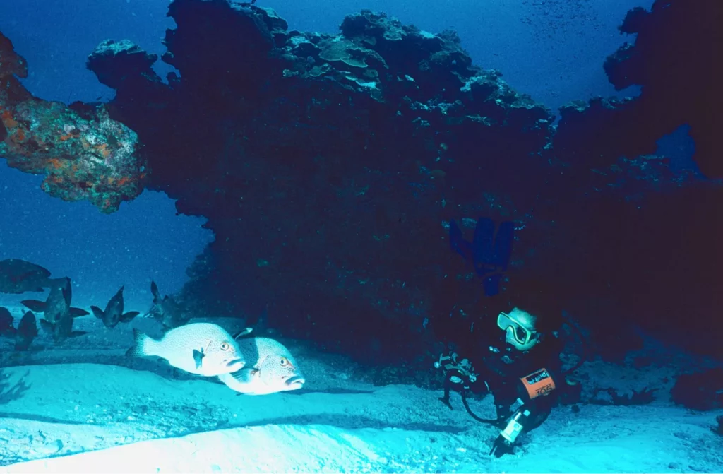
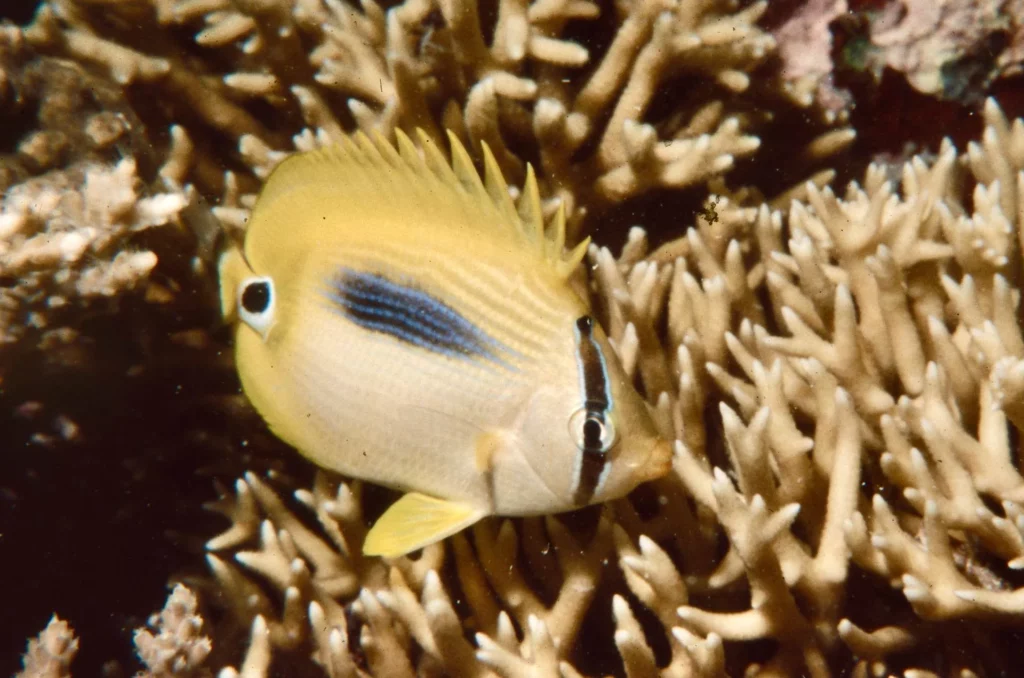
Erscott Hole is a shallow pool in the reef south of Comet’s Hole. A few coral bommies are scattered over the sandy bottom and, with the right sun exposure, coral development is striking in colour. Glass-bottom boats visit the site because of its great visibility, and sadly fish-feeding is practised for the snorkelling tourists.


North Coast
Malabar Wall is known as the Landslide and is located at the foot of Malabar Hill on the north side of the island. A horseshoe-shaped reef encircles a white sandy bottom, with a depth range of 10m, ideal for beginners. Small caves and swim-throughs with double roofs are found here, featuring painted morwongs, painted lobsters and coral reef fish.
Not far from there a sea cave goes deep into Malabar Hill, with fallen boulders at the entrance. This is Malabar Cave, where mangrove jack, sweepers and southern gobbleguts cardinalfish (Ostorhinchus rueppellii) are found wandering about.

The site is good for ambience photography, with pockets of air trapped on the ceiling reflecting the pale blue light outside. Nudibranchs such as Robo’s chromodoris, whitish with blue spots, graze on boulders outside the entrance, while lobsters and morays are found inside.
At the foot of Mt Eliza, the shark fin-shaped hilltop Old Gulch rises 147m above sea level. Down below, it penetrates the land like a fjord. A few sea-caves on the outside seem inviting, but beware of the swell coming from the north. The reef extends like a crown, with patches of white sand and the bottom lying at 14m.
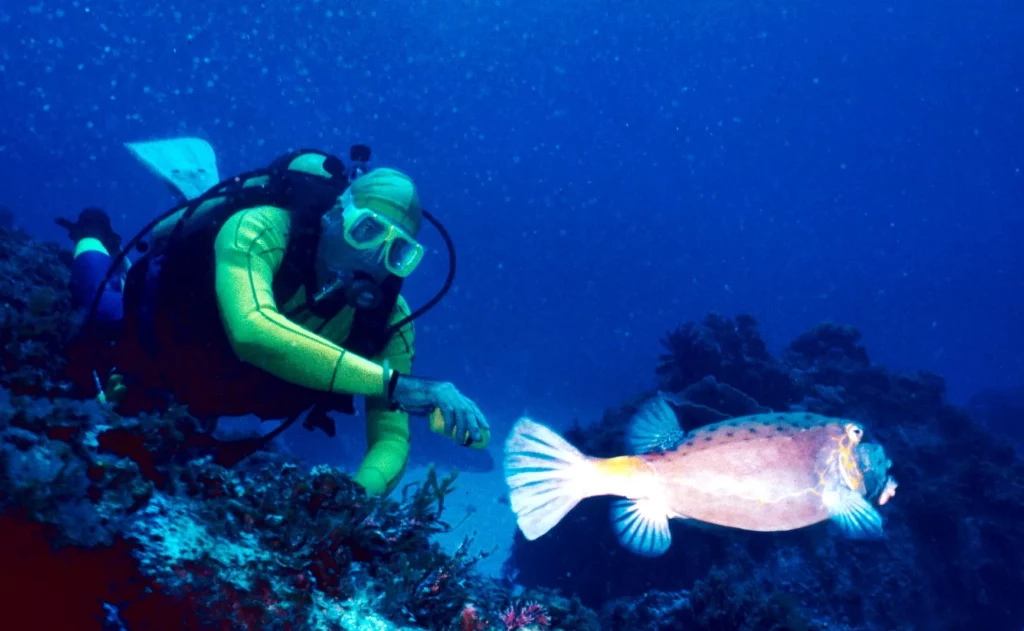
Blue-spotted yellow boxfish, flutemouth, almaco jack, silver trevallies and silver drummer roam, while crimson and white-spotted tomcat grouper hide in cracks.
Large sea urchins dwell on the seabed, hosting commensal shrimps, banded pipefish and even pleurobranchs. A Galapagos shark looking for prey passed me just beneath the surface.
Admiralty Islands
Favourite dive-sites are found in this group of seven islets and emerging rocks, scattered north-east of Lord Howe: North Rock, 10th of June, Roach Island, South Island, Noddy Island, Sugarloaf, Soldiers Cap and Mokambo Rock, where a ship sank in 1918.
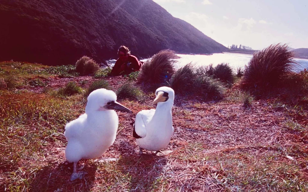
This is a haven for colonies of seabirds. Roach Island is a breeding ground for masked boobies, sooty terns, grey ternlets, common noddies and wedge-tailed shearwaters, and is a must-do -xcursion for birdwatchers when conditions are suitable. The boat ride starts at Ned’s Beach on Lord Howe’s east coast.
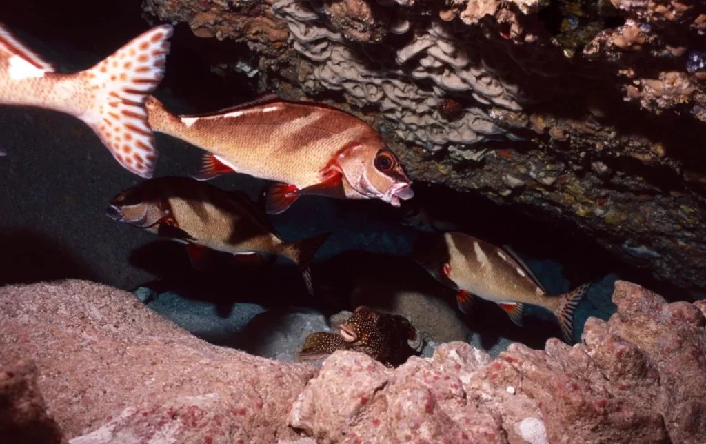
There are two protected dive-sites to the south-west of Roach Island, with channels cutting through the reef. The sandy bottom is at 25m. Coral mushrooms are rich in marine life, and I see a slipper lobster with amazing claws.
Sea stars graze on the rocks, as do the carnivorous crown of thorns. Corallimorpharians cover the walls of the channel. Double-header wrasse, Japanese boarfish and splendid hawkfish are frequently seen. Big turtles roam the rocks and morays hide in crevices. Be aware of the slight current that drives you towards the north, and do not get lost in the maze of channels!
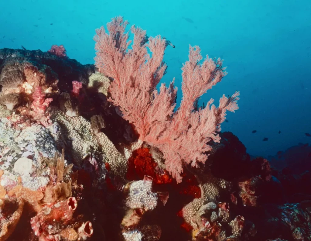
South Island is a rocky area with walls east of Roach Island. The reef drops to 30m, featuring gullies and gorgonians. Scorpionfish, lionfish, the endemic conspicuous angelfish (Chaetodontoplus conspicillatus) and white-eyed morays forage, and it’s a good spot for nudibranchs.
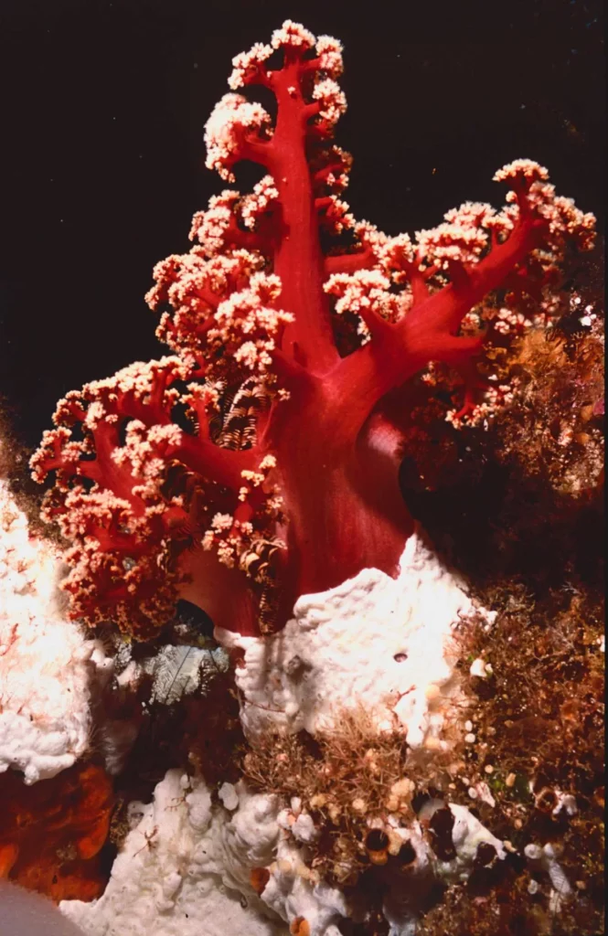
Noddy Island is a rocky islet surrounded by sand. Coral mushrooms are covered in black featherstars, gorgonians, ascidians and yellow sponges. It’s an enchanting landscape of deep blue and clean soft corals and ideal for spotting nudibranchs.

Still undiscovered wrecks lie hidden in the virgin depths of Lord Howe. In December 1830, the whaler George ran aground east of Mt Gower. The crew made it ashore and hid a chest of gold and coins that has yet to be found.
Ball’s Pyramid, 23km south-east of Lord Howe, is said to offer its best diving. Getting there is not easy when sea conditions are rough, and a suitable boat was not available while I was on the island.
At the surface
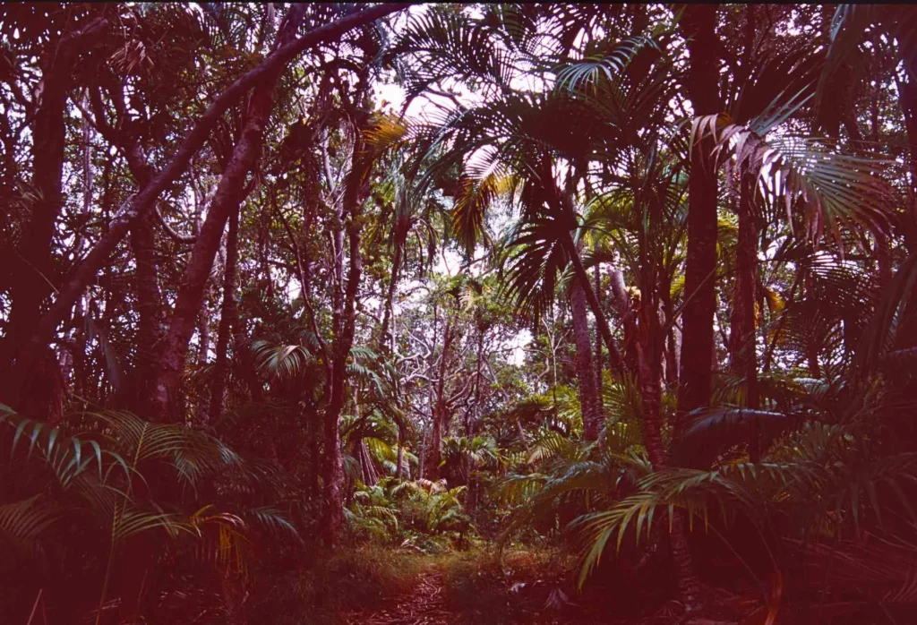
Lord Howe is covered by a thick forest in the lowlands, with Kentia palm, screw pine or tall Forkeedy trees, stilt roots pandanus, huge banyan trees and tea trees shaped by the wind in the northern hills.

A lush jungle grows on the slopes of Mt Lidgbird and Mt Gower, with tall thatched palm trees and two species of mountain palms. More than 300 plant species are found on the island, many of them rare or endemic, such as the yellow flowering bush orchid, the sweet-smelling jasmine or the wedding lily.
Seventy per cent of the island is covered by native forest, with plants related to those of New Caledonia, Norfolk Island and more recently to Australia and New Zealand. The rainforest in the south is home to most of the 57 species of ferns (23 endemic) and 105 mosses, as well as fungi and lichens.
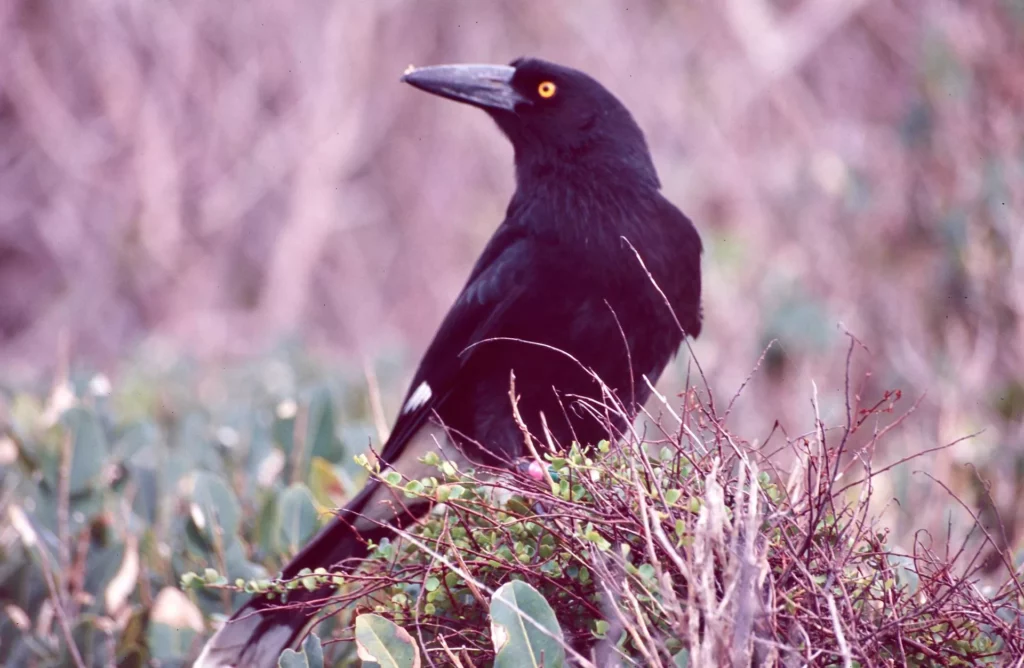
Birdlife is prolific on Lord Howe. Of 166 species recorded, 14 seabirds and 18 land birds are regular breeders. In 1788, when the island was discovered, 15 land birds were endemic, but colonists introduced mammals such as rats, pigs and goats so only six of those bird species survive today.
These are the Lord Howe currawong, white eye, golden whistler, sacred kingfisher, well emerald ground dove and woodhen, often seen roaming around, apparently tame, on the lowland forest floor.
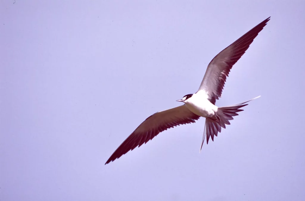
Rocky points, cliffs, hilltops and offshore islands are nesting grounds for exquisite seabirds such as sooty and fairy terns and black and common noddies. There are three species of shearwaters, four of petrels, red-tailed tropicbirds and colonies of masked boobies.

Settled for more than 165 years, Lord Howe has a population of 380 people, and those not farming, breeding cows or Kentia palms benefit from tourism to the estimated tune of Au $20 million annually. A maximum 400 tourists are allowed on the island at any one time to protect the environment.
The return flight from Sydney or Brisbane is not cheap at US $800, and the price goes up according to the season. Accommodation is usually luxury or self-contained apartments offering comfort for independent travellers – there are no backpackers’ places on Lord Howe! Diving remains a fledgling industry and the future looks promising.
Gifted with scenic beauty, the island is wonderful for walks. Trails are well-marked, easy-going or, should you wish to climb Mt Gower, challenging. A lack of leeches, bugs and snakes make Lord Howe a trekker’s paradise. The only wildlife you encounter are enchanting seabirds and elusive land birds.

The best walks take two or three hours, such as Malabar Hill and Kim’s Lookout in the northern hills or Mt Eliza with its sooty tern colony.
For a walk overlooking the seashore try Muttonbird Point and its colony of masked boobies, and if you want spectacular panoramic views, climb through the native forest of Mt Lidgbird to Goat House Cave, with its splendid flowerbeds of endemic wedding lilies.

Take a picnic and some drinks and you’ll feel like Robinson Crusoe overlooking his island kingdom in the middle of nowhere – simply out of this world.
PIERRE CONSTANT organises and leads trips with his company Calao Life Experience. Find many more of his extended dive-adventure features on Divernet.
My wife and I had the privilege of a few days on Lord Howe Island in January this year. It was easy to get around, and like nearly all accommodation our lodge provided bicycles.
It took just a few minutes to ride down to Dive Lord Howe. They provided good briefings, good hire kit and excellent guides. They felt safe, friendly and provided well organised recreational dives. It needs to be all those things as the nearest chamber is on the Australian mainland.
The viz was great, the water warm, the reef and marine life was healthy – it really was all pretty much as reported above.