The biggest no-take marine protected area (MPA) in Melanesia is set to safeguard marine life including sharks, manta rays, turtles, dolphins and seabirds while still supporting the Pacific country’s fisheries.
Papua New Guinea (PNG) has undertaken to protect an area of ocean about the size of the UK from destructive activities. Its Western Manus MPA will cover 200,000sq km of Coral Triangle within the Bismarck Sea, forming part of the new Melanesian Ocean Corridor of Reserves (MOCOR).
Melanesia encompasses PNG and Indonesian Papua, Fiji, the Solomon Islands, Vanuatu and New Caledonia. PNG says it is protecting what is claimed to be one of Earth’s biologically richest and least-explored ocean regions by banning fishing and other human activities.

“Papua New Guinea is one of the most biodiverse places on the planet,” says its National Fisheries Authority minister Jelta Wong. “Establishing the Western Manus MPA will allow us to preserve and protect our ecological legacy and, at the same time, ensure that our ocean continues to provide people with what we need – food and a source of income.”
Surveys have documented more than 700 reef-fish taxa, 300+ species of hard corals and remarkable deep-sea biodiversity in PNG, according to National Geographic Pristine Seas, and the proposed MPA will help to fulfil the nation’s pledge toward the global 30×30 goal.

Ocean Summit
The new MPA was announced to the 500+ delegates attending the first-ever Melanesian Ocean Summit, an assembly of regional leaders from host-country PNG, Fiji, Solomon Islands, New Caledonia and Vanuatu held from 11-14 May.
The planned sanctuary, described as a marine highway connecting shallows to deep and marked by underwater mountains, ridges and canyons, is intended to support species including sharks (scalloped hammerhead, grey reef, silky and blacktip), marine mammals (spinner and bottlenose dolphins, and short-finned pilot, Cuvier’s beaked and killer whales) and deep-sea creatures such as the hairy nautilus, colossal yokozuna slickhead and gulper sharks.

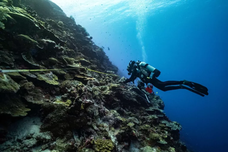
In 2024 Pristine Seas launched a three-month expedition with Communication, Education & Public Awareness (CEPA) and the Wildlife Conservation Study (WCS) to arm the PNG government with data to inform its ocean-protection priorities.
The team reported finding vibrant coral reefs but also a shortage of sharks and other top predators, indicating overfishing. They documented deep-sea species such as the yokozuna slickhead, never before recorded in PNG.
“At a time when coral reefs are in crisis, it’s exciting to see the Western Islands still shimmering with healthy corals and schools of fish like wahoo, rainbow runners and jack,” said Pristine Seas research VP Lindsay Young.

“This is not just a beautiful place, it’s a highly connected system, where shallow reefs, deep-sea habitats and open ocean waters are linked, supporting species that move across them. Although these reefs are among the healthiest in the Pacific, they are increasingly under threat from global warming, overfishing and plastic pollution.
“The new MPA comes at a critical juncture to protect these connections and ensure the long-term health of the ocean and the communities that depend on it.”
Endangered sharks
The scientists set the boundaries of the proposed MPA by tracking endangered grey reef sharks as they hunted for prey between shallow reefs and deep-sea habitats.

Some 6.7% of PNG’s industrial fishing and 10% of industrial tuna-fishing currently take place in the area, but the protection is expected to replenish food supplies through spillover to outside areas in which fishing is allowed. According to research, tuna catch-rates increase by 12-18% near the boundaries of large Pacific and Indian Ocean MPAs.
National Geographic Pristine Seas works with indigenous and local communities, governments,and other partners to protect vital places in the ocean through research, policy, and film-making. Since 2008, it claims to have helped to establish 31 MPAs spanning more than 6.9 million sq km of ocean.