Archaeological divers have excavated a large timber platform hidden beneath an artificial stone island constructed in a Scottish loch more than 5,000 years ago – and used a new technique to record it three-dimensionally.
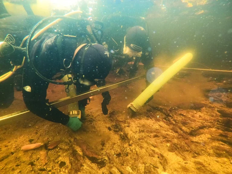
The stereophotogrammetry image-capturing technique, devised in 2021, was employed to solve the problems of recording the ‘crannog’ island in relatively shallow water. Using twin GoPro cameras deployed by scuba divers, the crannog was depicted as a single continuous structure visible from below as well as above the waterline.
This perspective would not have been possible using land or underwater surveying alone, say the archaeologists, and the use of the technique has now been described in a newly published study.

University of Southampton archaeologists teamed up with others from the University of Reading to carry out fieldwork on the crannog in Loch Bhorgastail on the Isle of Lewis, establishing that the edifice dated back further than Stonehenge.
Beneath the island’s stone capping the divers uncovered a layered timber and brushwood foundation, along with hundreds of submerged pieces of Neolithic worked stone and pottery from different types of jar and bowl that would have been used for cooking or feasting. The crannog had been accessed from the loch shore using a stone causeway, now under water.
“Crannogs are small artificial islands that are typically thousands of years old,” said University of Southamption archaeologist Dr Stephanie Blankshein, lead author of the study. “Hundreds exist in the lochs of Scotland and many remain unexplored or undiscovered.

“While crannogs were long thought to have been built, used and re-used, mainly between the Iron Age and the post-medieval period, we now know that some were first constructed much earlier, during the Neolithic between 3800 and 3300 BC.”
Several years of fieldwork have revealed the various stages of development of the Loch Bhorgastail crannog. It had started as a 23m-diameter circular timber platform topped with brushwood. Two thousand years later, during the Middle Bronze Age, more brushwood and stone were added, with further additions made during the Iron Age another thousand years later.

“While we still don’t know exactly why these islands were built, the resources and labour required to construct them suggests not only complex communities capable of such feats, but also the great significance of these sites,” said Blankshein.
Photogrammetry, using multiple 2D photos to create 3D computer imagery, is well-known for use at dive-sites, especially shipwrecks, but could not be employed at the crannog site.
“Fine sediments, choppy conditions, floating vegetation and distorted or reflected light all hinder shallow-water imaging,” explained Prof Fraser Sturt, principal investigator and director of the Southampton Marine & Maritime Institute.
“Photogrammetry is very effective in deep water but runs into problems at depths of less than a metre. This problem is a well-known frustration for archaeologists.”

The researchers solved the problem by using two small waterproof cameras offering low-light performance and a wide field of view. Locked at a set distance apart on a frame, this ‘stereo’ method provided precise overlapping of imagery that compensated for any missing or disrupted data.
The cameras were moved through the water by a diver with positioning described as controlled to centimetre accuracy in the same way as aerial drones.
“By combining stereophotogrammetry, drone technology and some innovative post-processing of the data, we have managed to set out an accessible approach that is portable and cost-effective,” said Blankshein, who hopes that the technique can now be applied to investigations at other crannog sites.
The study, the first from the University of Southampton’s Coastal & Inland Waters Heritage Science Facility is published in the journal Advances In Archaeological Practice.
Also on Divernet: Divers backdate ancient mini-islands